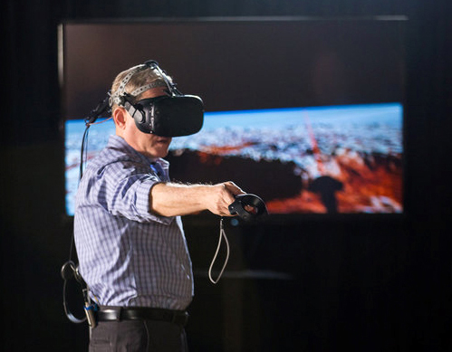
CuriosityStream.com and production company, Sky Works Digital requested Home Run Pictures create a virtual reality experience using data from the NASA New Horizons space mission to Pluto. Used at a Curiosity Retreat science conference where NASA mission director Alan Stern was speaking, the HTC VIVE simulation app was a very successful dramatic experience for attendees as an article at the online site, Huffington Post reported. After creating animated sequences for several science documentaries for the CuriosityStream online streaming site, the next step was obviously to allow the conference attendees to take a stroll on the surface based on the real imagery sent back by the NASA flyby mission.
INTRODUCTION:
Let's take a quick look at the producton pipeline we developed to create the
simulation… we were asked by the client if we could use a mosaic of images that a
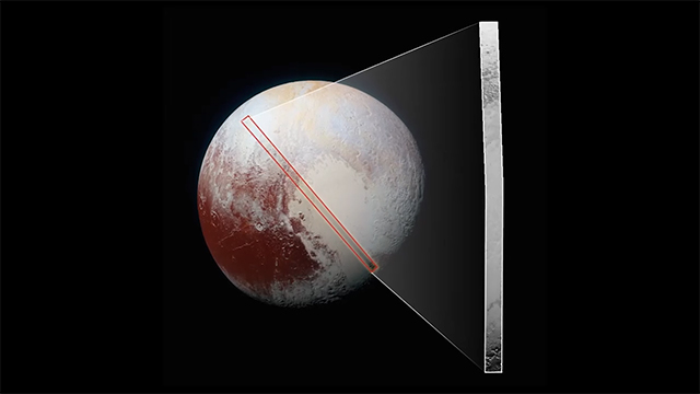
NASA scientist had assembled as our base… these are the best resolution images from the vehicle's cameras because of the spacecraft's flyby path… it was a challenging request since we were expecting to just create a few smaller areas to visit in the simulation. The strip was called "The Noodle," and it streatched across a wide range of geological types that NASA had discovered.
THE PIPELINE TO ACCOMPLISH THIS:
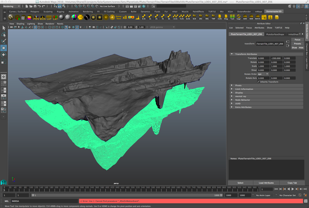
We immediately saw a problem… since there was no elevation data available, all that we had was this long image… made from images of various resolution and detail due to the different distances they were taken from… and second, if you look at the diagram below, you will see that since the strip’s imagery actually curves around Pluto’s rim, the perspec;ve in the photo is not flat on… and the sunlight striking the terrain along the strip is coming from an ever changing angle… this creates shadows of differing lengths depending on where you are… so what do you use to determine how high the terrain features are?

We came up with an approach to subdivide the noodle into smaller patches and apply some geometric concepts individually based on shadow length… also the texturing of the surface required some special scripting to develop specific, shall we say, brushes, that our artists would use to create the geological features and coloration that NASA was discovering.
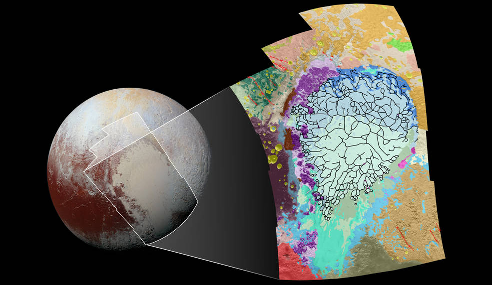
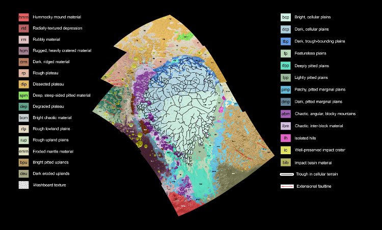
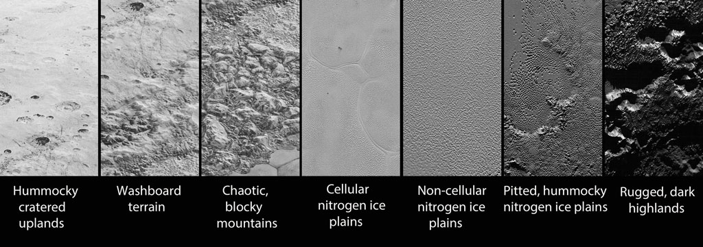
There were three main areas that were selected as sites to visit and have much more detail than the entire strip, they represent different geological formations… we used Mudbox to initially sculpt the meshes, then imported those into 3DCoat for continued reworking and texturing, and then finally Maya to assemble all the patches as one long mesh to import into Unity…
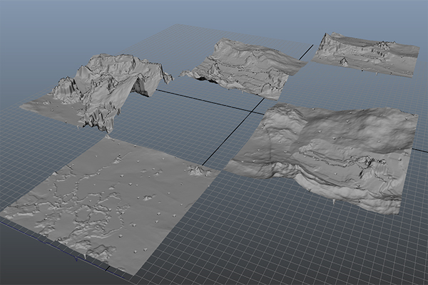
The mesh was huge… much larger than what even the high-end graphic cards we
were using with the HTC VIVE are designed to handle all at once… Using the Unity game engine, we came up with several “load on demand” scripts that used lower resolution patches off in the distance which then only loaded the higher resolu;on information when you got closer… as we continued development, we tried various other compression and optimiza;on schemes to improve the performance…
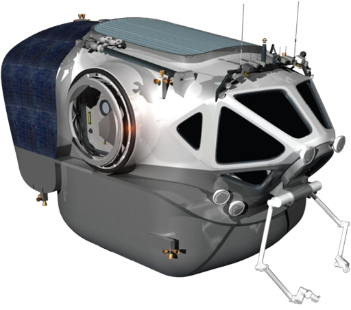
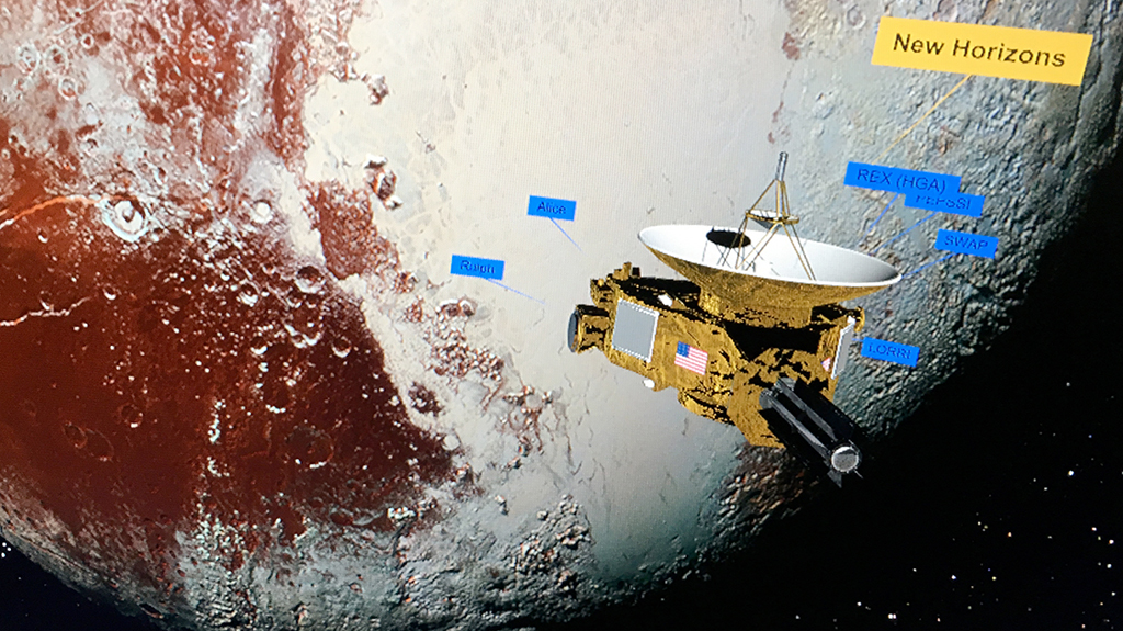
The “home” position in the VR is inside the NASA Space Exploration Vehicle or SEV… the VR loads placing the explorer in the spacecraft and the computer screens in the spacecraft are used to navigate to the various areas in the simulation… the VIVE's wands are used to select various options and fly the craft…
Here we are inside the SEV looking out the front windows at one of the the terrain
locations…
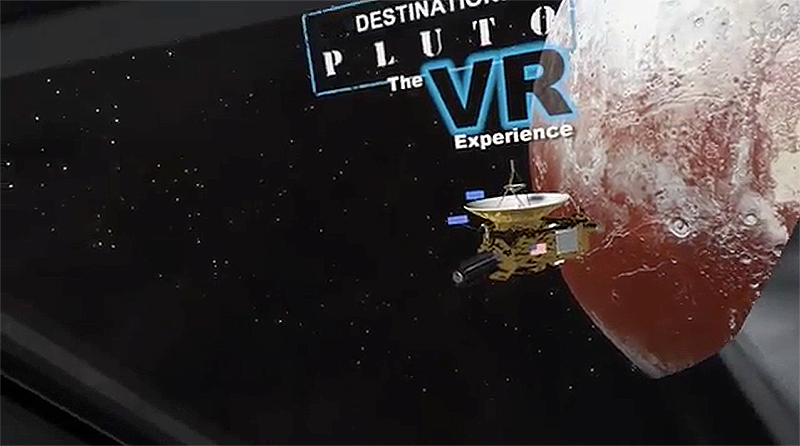
At startup you are near the New Horizon spacecraft as it flies past Pluto… here we are
looking out a window of the SEV…
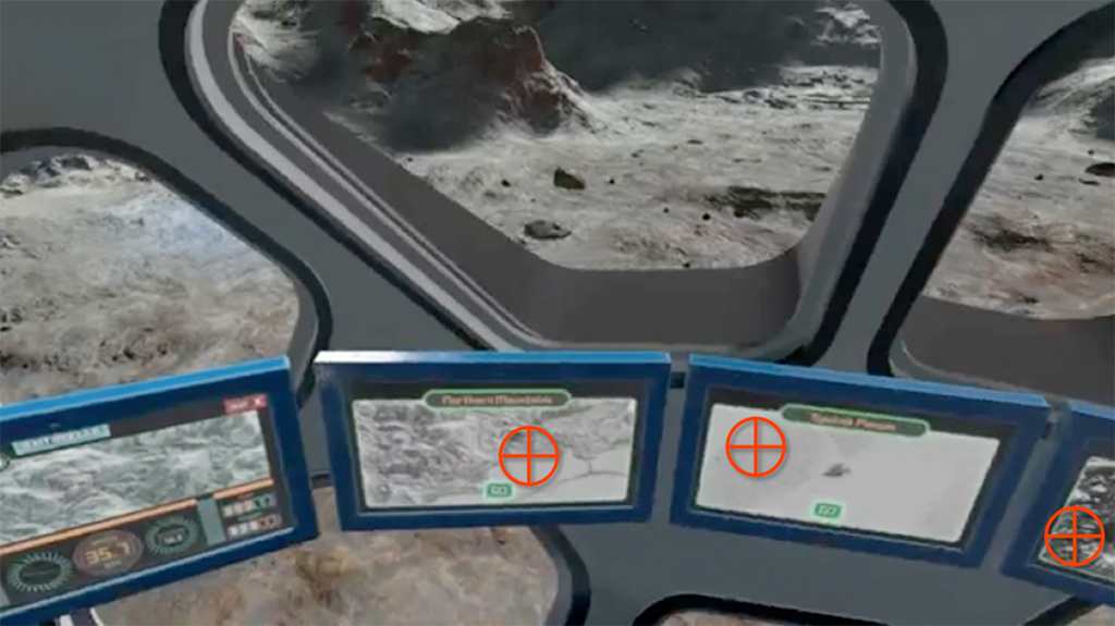
A pop-up panel is used to select options… there is a selection for the scale of the
terrain, from real-human-scale to where the terrain is scaled down… obviously realhuman-scale requires more effort from the graphics card…
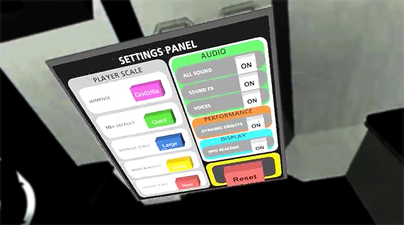
Keeping with the educational purpose of the simulation, there are label tags that pop
up describing various things you encounter…
The blue beacons scattered around the terrain turn into museum style placards and
explain points of interest when you get near…
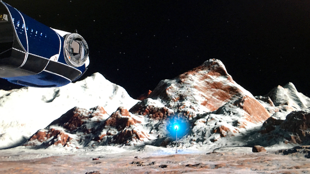
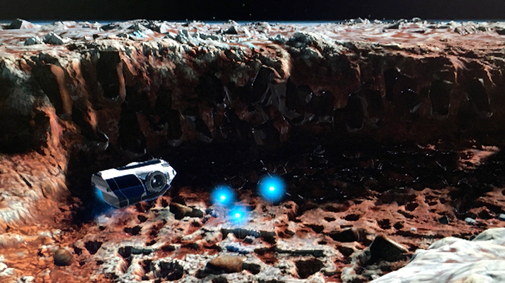
And of course in some area, like here in the twilight canyon of Krun Macula, there are
rocks you can pick up with the wands and throw quite long distances as the low gravity on Pluto is
properly simulated…
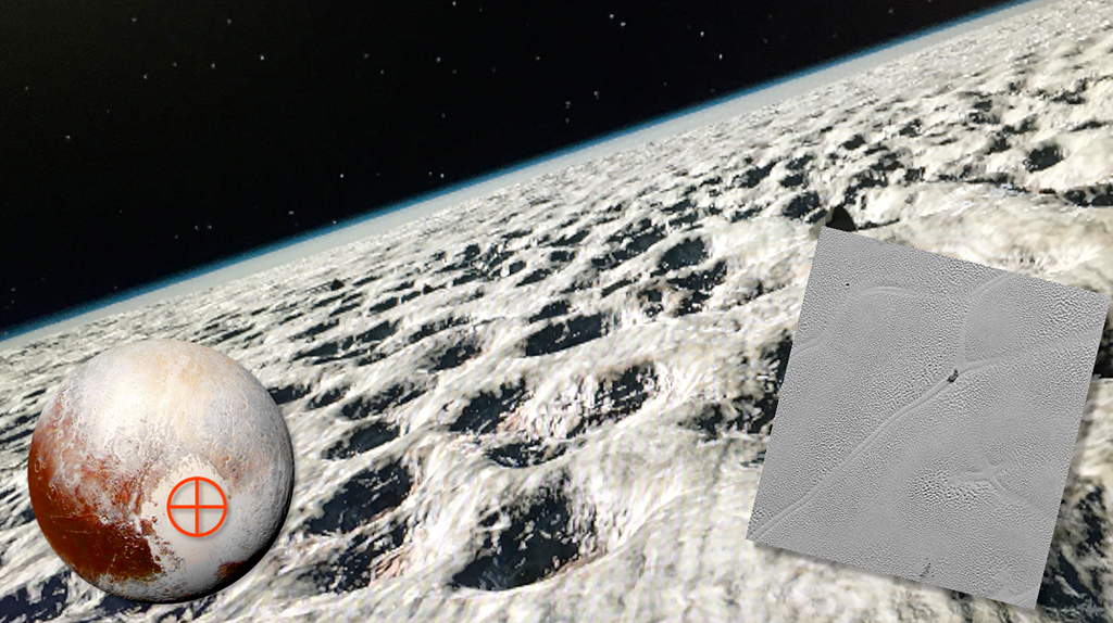
As I said the three areas you can visit are different types of geological formations…
here we are above a frozen nitrogen glacier called Sputnik Planum… a reference
image is on the right… the pits are caused by ice sublimating and range in size from
small cars to large houses…it’s the heart shaped area you see in the full hemisphere
images of Pluto…
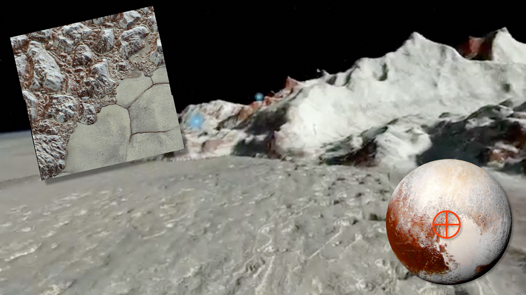
This is a mountainous region I can’t pronounce… something like Al Ee-DREE-see
MON-tez… it’s the north shore of the heart-shaped glacier I mentioned…
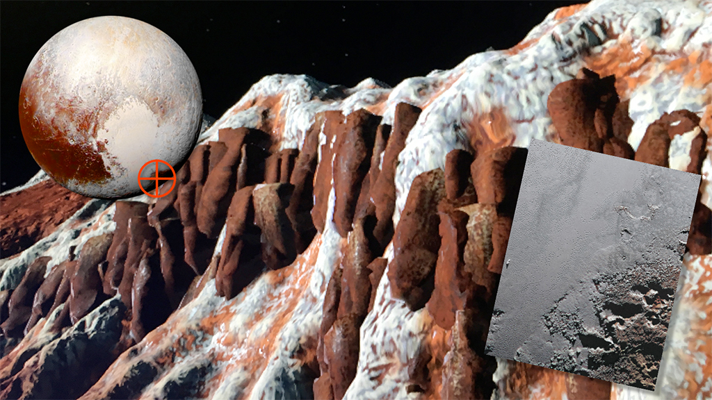
This is an area called Krun Macula… filled with canyons made up of different colored
ice formations… red is methane ice, white is either water or nitrogen ice…
And here’s a short DEMO VIDEO…
If you have a VIVE… Destination: Pluto, The VR Experience, in its current version is
available for download at the online Steam site… and it’s free…
That completes another Home Run Pictures' "Inside the Production." If you would like more information on VR@Home Run Pictures, just give me a call or drop me an email.
-TC
© 2018 H o m e R u n P i c t u r e s